Two Loves I Have…

Standard

24.9.2017

I don’t spend enough time outdoors these days, and I definitely don’t spend enough time writing. I’ve been in Warwickshire, walking intermittently, for nearly two and a half years, without really setting something down, beyond fragments in notebooks and half-started word documents. This doesn’t mean I haven’t been thinking about my walking, and my relationship with this place, and what that means for my relationship with places in general. I’ve tried several times to express my thoughts on being here and not quite teased them out. But let me try again.

I went out today and retraced much of a walk I did back in May, up near Henley-in-Arden. It’s early autumn and the colours are starting to come in; I’m keen to go out again in a couple of weeks and see how much more the yellows and reds and pinks and oranges have seeped into the countryside. Some trees are already blazing, putting all that green to shame. I should say right now, I fucking love autumn.

When I first did this walk, accompanied, we walked through thick oil-seed rape up to my neck. Nettles clustered around the gates and stiles. My legs were a litany of plant-inflicted damage, scratched and stung and blotched all the way to the tops of my thighs. These same fields today were cropped close, the walking easier, although I missed the wildflower meadows and the riotousness of life that comes with spring.

I walked for four hours and didn’t see a single other walker. Dozens of cyclists passed me on the lanes into Ullenhall. It is excellent cycling country. I don’t know if it’s excellent walking country. It’s hard, walking here, not like the Lakes, where there is always height to aim for, or avoid. I find Lake District walking much easier than Warwickshire walking. Mentally, I mean, because here I always have to keep an eye on the map, matching every fence and stream and lane to its symbol. I pay far more attention to the contour lines because I have to, because, really, one field looks much like another. And so, there is a certain satisfaction in successfully making it through this country. Is it more satisfying than the Lakes? How can I answer that?

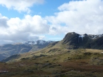
Cut me open and you’ll find a map of the Lakes carved into my heart. It’s a love I’ve always known, bred in me from birth, through family allegiance, a love passed down as an heirloom. It’s a constant ache, an addiction that always needs feeding and every time I visit I want more. I miss the Lake District with my whole soul when I’m not there and when I am there I can never get enough. It’s a passion: wild, uncontrollable, ever changing, ever deepening, it’s Heathcliff and Cathy, except I’m Heathcliff, possessive, lustful and violently in love with a thing I can never quite grasp.

I had to learn to love Warwickshire, but love it I do, at least this little portion of South Warwickshire across which I wander. It’s a far quieter, gentler love, but equally complex. I get so much more disoriented here, more fearful of being physically lost (although why should I be scared?). Perhaps too that necessary dependence on the map means I can never quite lose myself mentally which is certainly something I like to do. Because, I suppose, I am still learning – gleaning; an apt word in this agricultural landscape. But that is what place is – a palimpsest of all the meanings that we bring to it – and it’s an idea I am fascinated by (witness what I wrote on leaving Grasmere).

My relationship with the Lakes is deeply and fully ‘big-R’ Romantic, because, hell, how could it not be? I don’t know an equivalent for how I feel about Warwickshire, but I’m sure I romanticise it. The national footpaths here are the Heart of England and Arden Ways overlaid on one another, and truly I feel this is the heart of England, feel close to an ancient history, a sense of the the land being worked and known and worked again. It has a strange, unnerving, sustaining power.

However I choose to define it, the truth, today, is this: when I start walking, the words come running.

Ode to Stock Lane – on leaving Grasmere, December 2014

Standard

I love a public road: few sights there are

That please me more: such object hath had power

O’er my imagination since the dawn

Of childhood, when its disappearing line,

Seen daily afar off, on one bare steep

Beyond the limits that my feet had trod,

Was like a guide into eternity,

At least to things unknown and without bound.

Stock Lane joins Town End to Grasmere village and there’s a stretch of it, around 200 metres long, from the roundabout on the A591 to the carpark, which I have come to think of as holding all the things I have been and experienced this year. I couldn’t count the number of times I’ve walked this road and it has seen me in every state, in every light: I have walked it sober; I have walked it drunk (many times); I have walked it during the day and late at night; I have seen the fields on either side in golden light on the most perfect summer evening imaginable and been soaked by rain coming from every direction; I have seen it crowded with people and utterly deserted; I have stood for ages at the last streetlamp gossiping and smoking; I have lost track of people in the dark and run shrieking hand-in-hand with my friends; I have stood and stared in helpless awe at the full moon rising and the stars and the mist slinking up from the lake, across the fields and over the road; I have argued with boys chasing sheep; I have had conversations of every variety, banal and intellectual and incoherent and delighted; I have been joyous and miserable and angry and content. It’s also probably the best place for feeling how beautiful Grasmere is, surrounded by hills on all sides, held in a cradle of crag and turf and water. I will never get bored of that view of Dunmail Raise (there’s a reason the A591 from Windermere to Keswick was voted Britain’s favourite road). I have loved watching the colours of Silver How changing over the season and seeing the first snow on the tops up around Easedale Tarn.

Stock Lane has taken me to and from some of my most treasured moments from my year in Grasmere. It isn’t a destination, or a point of departure, but that’s probably why it has taken on this memorialising role. Wordsworth understood how we imbue places with meaning, even if we’re just passing through. We leave a trace of ourselves, to be rediscovered when and if we return. On Stock Lane I have left many selves, standing under the streetlamp, running down the road, staring at the sky or simply walking somewhere else.

(with thanks to AL for the photo)

Into Mosedale

Standard

Loweswater – Mosedale – Floutern Tarn – Loweswater. 3.8.2014

A day of mixed weather – always threatening rain, flirting blue sky, splashes of weak sun – we left Loweswater following the bridleway to Ennerdale. As the lane climbed into Mosedale, crows and ravens sat on the walls, rising in their murders and unkindnesses as we approached. One big young raven, beak evilly hooked, hopped along the wall ahead of us; a dead sheep on the other side of a wall providing the explanation for the presence of so many of these birds of ill-omen. Through a gate and out into the valley proper, one path to the right leading up Mellbreak, the other, ours, alongside a small fir plantation, with one ash tree, its leaves beginning to redden, fretting in the wind.

Mosedale is quiet and lonely. Today in the wet it was very green, the bridleway clear at the start but soon merging into bog and marsh, water oozing up under each foot-fall, the black peat mixing with the red-brown earth. The river ran high and fast and loud, horseback brown. The head of the valley widened ahead of us, our path meeting a pass from Crummock Water, alongside Scale Force, and continuing West to Ennerdale. Along this pass we climbed up to Floutern Tarn, where Coleridge had been 212 years ago almost to the day on his own walking tour of the Lakes in August 1802. The view from the foot of the tarn tumbles down the valley towards Buttermere. The road from Buttermere into Newlands was pale grey amongst the darker grey of the rain soaked fells. The cloud cover over the higher fells made them rise into the mist infinite.

After lunch at the tarn, we took another smaller path North, and ahead saw the Solway Firth, the Scottish coast and the mountains of Dumfries and Galloway. And still behind us the sky grey, rain, cloud, the rain moving in thin veils drawn by an invisible hand. The path skirted Hen Comb and brought us up onto the brow of Loweswater Fell, again looking back, the distinct, geometric shape of Honister Crag still just darker than the air around it, but in the direction we walked, our own Lorton Vale in sunshine, with Fellbarrow above, Loweswater blue, twinned with the sky. Always on our Eastern hand, Mellbreak clothed imperiously in purple heather, with salmon pink edging.

The path peters out at Little Dodd – we dropped down the slope, easy going, and decided on a small act of civil disobedience to bring us back to Loweswater, a clamber over a padlocked gate and across the fields to an old barn and then down a straight track to Maggie’s Bridge, a perfect, lovely packhorse bridge. But trespassing these meadows brought us into the heart of the whole, the hills and the fields and the lake.

The Hidden Places

Standard

This is a post I’ve been mulling over for some time, having repeatedly put off writing it, and then finding myself with more material for it. I often suspect myself of being something of a misanthropist, and rarely more so than when out walking. I relish being alone in a valley or having a summit to myself and I am always on the lookout for places that seem generally unvisited and quiet. A quick disclaimer: I do not dislike walking with other people; I think great company can elevate a walk far above its highest contour line. But if I have started out alone, I rather like keeping it that way.

This is something I often consider as I’m walking, but it was particularly present in my mind (and then remained so) after two walks in as many days in April, both in some way or another with secrecy as their aim – one in company, one alone. The first to a ‘secret valley’ on a well known, but henceforth nameless fell (part of my misanthropy is in the smugness I feel in selfishly keeping it hidden from too many feet). We knew where to look, but none us had been there before, so, until we found it, there was some doubt that we even would. But our directions were good, and here we were in a cleft in the side of the fell, more of a ditch than a valley, but to my mind at least very secret, and very quiet. Climbing up to the ridge above this cleft, the fell dropped away to the valley floor. We lay in the sun for ages, some dozing, quietly talking every now and then, other times in comfortable silence. When we at last got too cold, we resurfaced from the valley, receiving, I like to think, some curious looks, appearing as we did to have come out of nowhere. I looked at the faces of the many people on the main body of this fell and smiled to myself to think they had not been where I had been, and that I knew something they didn’t. I returned alone a couple of days later: a sunny day, but in the valley the wind came from all directions and I struggled to find a sheltered spot. The valley is predominantly full of jumbled and sharp rocks, but interspersed with soft green turf. It feels like an ancient mountain pass, and with the sun behind a cloud it is a place where goblins and wolves shadow your movements as you seek shelter from the unrelenting wind.

The wind was high when I walked alone the day after the first secret valley trip. I had an aim once again, to climb Tarn Crag, and my motive, to get away from the many people who visit Easedale Tarn. I love Easedale Tarn, but part of what I love about it is the ease with which you can get away from its many visitors, often by simply crossing the stream from one shore to the other. Better than this is the short steep scramble up to Tarn Crag. The summit is not the round rock formation seen from the tarn itself, but this outward face provides a perfect birds-eye view of the tarn and an excellent study of Blea Rigg and its attending crags.

I am increasingly sure of myself in leaving the main path and just striking out into the landscape, my aim being a patch of ground which catches my eye in the distance. This is what I did another day, a month after that weekend in April, although it wasn’t my original intension to add to my litany of hidden places. I started off up Silver How fairly late in the afternoon, planning to sit up there for a while reading, possibly drawing. I’ve found Silver How to be reasonably quiet, despite its proximity to Grasmere and relatively small height (compare the popularity of Loughrigg). But when I came to the top of the rock steps that climb steeply to just beneath the summit, instead of turning up to it, I carried on forward, dropping down into the rolling land between Silver How and Blea Rigg and the Langdale Pikes and which, according to the map, is still part of Silver How. It feels however like it should have a name all to itself to fit its separate identity. I have written before of how much I like this high land and, well explored as I know it is, it retains some sense of mystery; it feels to me rather like Dartmoor, where any wandering might go on indefinitely. I know too how it changes in mist and becomes truly hidden and possibly dangerous. From my inital high vantage point I saw a gash in the land ahead and knew there would be water, so that was where I aimed my steps. I ended up in a small gully, but deep enough to be hidden from view from the higher peaks around. I lay down and had no view but the grass and the clear water and the big sky. I followed the gully back down the hill side until it crossed the path down to Grasmere; at this crossing, someone had left a backpack and a hat but this someone was nowhere to be seen. The gully deepened at this point, and I climbed up above it, searching for this person beside the stream below me, assuming that they had had the same idea as me. But I never saw them, and I headed back down to Grasmere, seeing no one else until I passed Allan Bank, the backpack and hat still in my mind lying beside the path.

High days on High Raise (part 2: photos)

Gallery

High days on High Raise

Standard

Monday 3rd March 2014

You could hardly imagine a better day for walking –blue sky, white clouds, breezy. It is wet under foot after days of rain, but not unsurpassable; the paths between Silver How and Blea Rigg are easy to follow, but I know where I’m going anyway: I was up here in low cloud two days ago and thrilled myself with my successful navigation, so now it’s just a question of actually seeing where I’m going before I get there. From Silver How the view south to south-west is full of lakes: Grasmere, Rydal Water, Elterwater, Windermere, each more silver than Silver How has ever been. The Coniston fells are huge and snowy, and the Helvellyn range shines white. The route from Silver How to Blea Rigg runs up and down over soft turf and marshy patches, past small tarns, and below crags. There are dozens of miniature summits summoning the walker to leave the path and taste their offerings. Two days ago, in the mist, this area was other worldly: hills appeared and disappeared, changed shape, changed height; I heard voices belonging to people who I never saw. I was encased on my own private mountain, and the same is true today, but with better visibility. Between Silver How and Blea Rigg I do not meet a soul; only upon Blea Rigg does a raven sit on what little is left of the summit cairn and croak at me.

Blea Rigg is rough and rocky, barely separate from the rest of the surrounding upland. The views on this day are vast in all directions: a vertiginous swoop down to Easedale Tarn, Morecambe Bay winking, the Pennines in their solid strip across the country. And above me, the higher tops of the Langdale Pikes, sleeping lions of the Lake District; behind, unseen, but higher still, High Raise, hiding its offering of snow and bog and glorious sights.

I continue up to Sergeant Man with Pavey Ark on my left, in shadow and threatening. I can see Jack’s Rake in its unlikely but definite diagonal line across the rock face. A short scramble to the top of Sergeant Man, patches of snow in nooks in the rock. I drink tea, check my compass and carry on over the open upland to High Raise. The summit cairn is hidden from Sergeant Man but it’s just a question of walking North-West, a compass point I especially like for reasons I may yet expand upon. It feels like moorland up here, vast and featureless and if it wasn’t for the exquisite panorama few people would come up here because there’s nowhere to hide and nothing to explore. But from the summit cairn one of the best views in the Lake District unfolds itself – I can see everything. It is excellent in every direction and as I look, one of the jets that so often scream through the valleys flies exultant around half the panorama: Catbells, Maiden Moor, Dale Head; across Honister Pass, over the sharp dropping away of Honister Crag, the back of Fleetwith Pike, Mellbreak, High Stile, Brandreth, Pillar, Green Gable, Great Gable, Great End, Scafell Pike, Scafell, Esk Pike, Bow Fell, Crinkle Crags, Pike o’ Blisco; then it becomes no more than a white fleck in the sky, flickering out over Cold Pike, Swirl How, Coniston Old Man, Wetherlam. It takes no more than a minute.

But there is more to see than this – Skiddaw and Blencathra in their splendid isolation. A flash of Derwentwater. The Irish Sea. The Solway Coast. Ingleborough. The Helvellyn Range and St Sunday Crag and Fairfield and all its subsidiaries. The lovely Langstrath Beck in the vast trench it has carved for itself over eons. And here are hundreds of memories crowding in of other walks, of swimming naked in Black Moss Pot in the Langstrath valley, of camping in yurts at Seatoller, of my very tall friend realising as we stood atop Scafell Pike that he was ‘the highest thing in England’; of walking the Coast to Coast and playing Monopoly at Helvellyn Youth Hostel and falling asleep to the sound of the stream outside the window. Last time I was on High Raise, a year and a half ago, the air was utterly clean and pure and it was the first time I’d been up there and I recall the delight in checking Wainwright’s diagram of the view and reeling off the names.  I linger a long time.

The descent to Easedale Tarn is long and delightful because it involves scrambling and there are few things that I enjoy more than scrambling. You have to walk with your eyes in your feet. The shadows are lengthening in the liquid light, streams converge before reaching the tarn, which is deep true blue. I sit at Easedale Tarn a long time too, having it all to myself, something to cling to at such a popular spot on such a beautiful day. I am always looking ahead, always planning the next walk, idealising future summer days spent swimming in the tarns and reading in the sun. In an ideal world I would never go indoors again.

(photos to follow)

“Everybody likes Loughrigg”

Standard

As an appendix to my last post, Wainwright’s description of Loughrigg, saying everything I wished to. From Book Three: The Central Fells.

“Of the lesser heights of Lakeland, Loughrigg Fell is pre-eminent. It has no pretensions to mountain form, being a sprawling, ill-shaped wedge of rough country…and having a bulk out of all proportion to its modest attributes; but no ascent is more repaying for the small labour involved in visiting its many cairns, for Loughrigg has delightful grassy paths, a series of pleasant surprises along the traverse of the summit, several charming vistas and magnificent views, fine contrasts of velvety turf, rich bracken and grey rock, a string of little tarns like pearls in a necklace, and a wealth of stately trees on the flanks…In brief, this fell has a wealth of interests and delights, and for many people who now find pleasure in walking all over the greater mountains it served as an introduction and an inspiration. Everybody likes Loughrigg.”

Loughrigg via Rydal

Standard

A rainless Sunday, so how can I resist the call of the fells? Admittedly I’d probably have gone out today whatever the weather, but any chance not to wear my parachute-like waterproof trousers is one I savour. I also forgot my camera and my pen ran out half an hour in, so my phone became both camera and notebook. I suppose this is what normal people do these days; it’s not a habit I’ll be developing though. But enough disclaimers; what of the walking?

It doesn’t make the greatest sense to go to Rydal in order to climb Loughrigg, but it avoids the roads and today I am in the mood for meandering. I take the old coffin route between Grasmere and Rydal, but soon break off to explore White Moss Common where the view over Rydal Water is framed by Loughrigg on my right, the steeps of Nab Scar to my left, and Wansfell straight ahead. The fells at the moment are covered in variations of brown and orange with Nab Scar in particular being richly rust-coloured. The sun begins to come out over Loughrigg as I sit absorbing it all.

Image

Back on the coffin road, I soon turn off again to take a path that is barely more than a sheep-track, following it up a beck, terminating at what seems to me a cross between a dam and a bridge, where there is a fine view across to Loughrigg, and the air is filled with the sounds of the full beck. I lie on my stomach and look down into the pool below the bridge, trying to tune my ear to the sounds of the waterfall, attempting to distinguish between the overriding roar, the gentler bubbling underneath, wondering if some places sound hollower than others. It’s high above the path and a point to return to on a long summer evening, to bask and nose around the pools.

Image

I try to imagine carrying a coffin over this rough path. My pace is steady and my feet are sure, but how sure would they have to be to keep such a weight from falling? It’s not as if there are professional pall-bearers. Yet those carrying the coffin would most likely be men who knew the fells, the broken surfaces, the many chances to trip or twist an ankle. Would grief get in the way of that knowledge? Would they even be grieving?

Down in the valley, the river Rothay is high and fast. I find a rocky outcrop at the southern tip of Rydal Water where an oak tree stretches out into the water. One day I’ll climb to the tip, but for now I sit astride a low branch and eat chocolate. The lower slopes of Silver How are touched with sunlight and the water washes the rocks below my dangling feet. A man in waders is fishing waist-deep in the lake, moving his net in graceful swooping motions. It looks very calming and I’ve always imagined that I’d enjoy fishing: an excuse to sit and think; the prospect of fresh fish for tea.

Image

I walk along Loughrigg Terrace and look across the valley to where I sat above the beck earlier in the day. I like the fact that I probably wouldn’t have noticed it if I hadn’t been there earlier. I double back at the end of the Terrace to climb Loughrigg proper. I have often thought of Loughrigg as a little lump of a fell, but I realise how unfair an analysis this is. I think as I ascend what a good climb it, a lovely amalgam of steep and flat and rough and smooth and even demanding the odd scramble. Although it doesn’t take very long at all to reach the top, this is certainly a fell that kicks back. And what a reward! What a masterstroke to save that vast view of Windermere to the very last moment. If it had been planned out it couldn’t have been done better. The whole panorama is splendid and the top itself is a delight – all tussocks and hummocks and little tarns, a gem of microcosmic exploration. I could wile away hours up here. As it is, I find a sheltered spot and eat chocolate and an apple whilst eyeing up the Fairfield Horseshoe, my current heart’s desire. The sun hits the fells in patches; spots of light making me think of Wordsworth’s ‘spots of time’, as though each golden patch were a moment remembered.

Image

I descend quickly and come back via the river path and through White Moss woods, finishing as I began on the coffin route. My craving for the high tops is still unsatisfied but I have been ‘in the great City pent’ too long and my spirits rise with every contour line. How Romantic of me.

On going a journey

Standard

The beginning is always the hardest.

Where to start? With the obvious: I love walking with a fervour. Having just moved to the Lake District, I’m about to have the opportunity to pursue this love with a regularity that I never have before.

A great walk is hard to define. My favourites have been those with variety, demanding climbs, far-reaching views, big skies, but I couldn’t describe precisely what leads to my taking my boots off in the evening feeling that, yes, that was a great walk.

But there are definitely ways towards this feeling and in all that I’ve read on walking, it is William Hazlitt who best sums up how to go about it:

“Give me the clear blue sky over my head, and the green turf beneath my feet, a winding road before me, and a three hours’ march to dinner – and then to thinking!…I laugh, I run, I leap, I sing for joy.”

The beginning is not so hard in walking – you just go. And so that’s what I will be doing. With the fells just beyond my garden gate, I’ll be out there at every opportunity, running, leaping, and I wouldn’t be surprised if I’ll be singing for joy.